| Hardware Parameter |
| Working voltage |
16V |
| Input voltage |
4S ~ 6S (14.8V~25.2V) |
| Output voltage |
5V (connect with PWM) |
| Dynamic current |
750~1500mA @16V |
| Power consumption |
Average 12W, Max 24W |
| Working environment temp. |
-20℃ ~ +50℃ |
| Output (optional) |
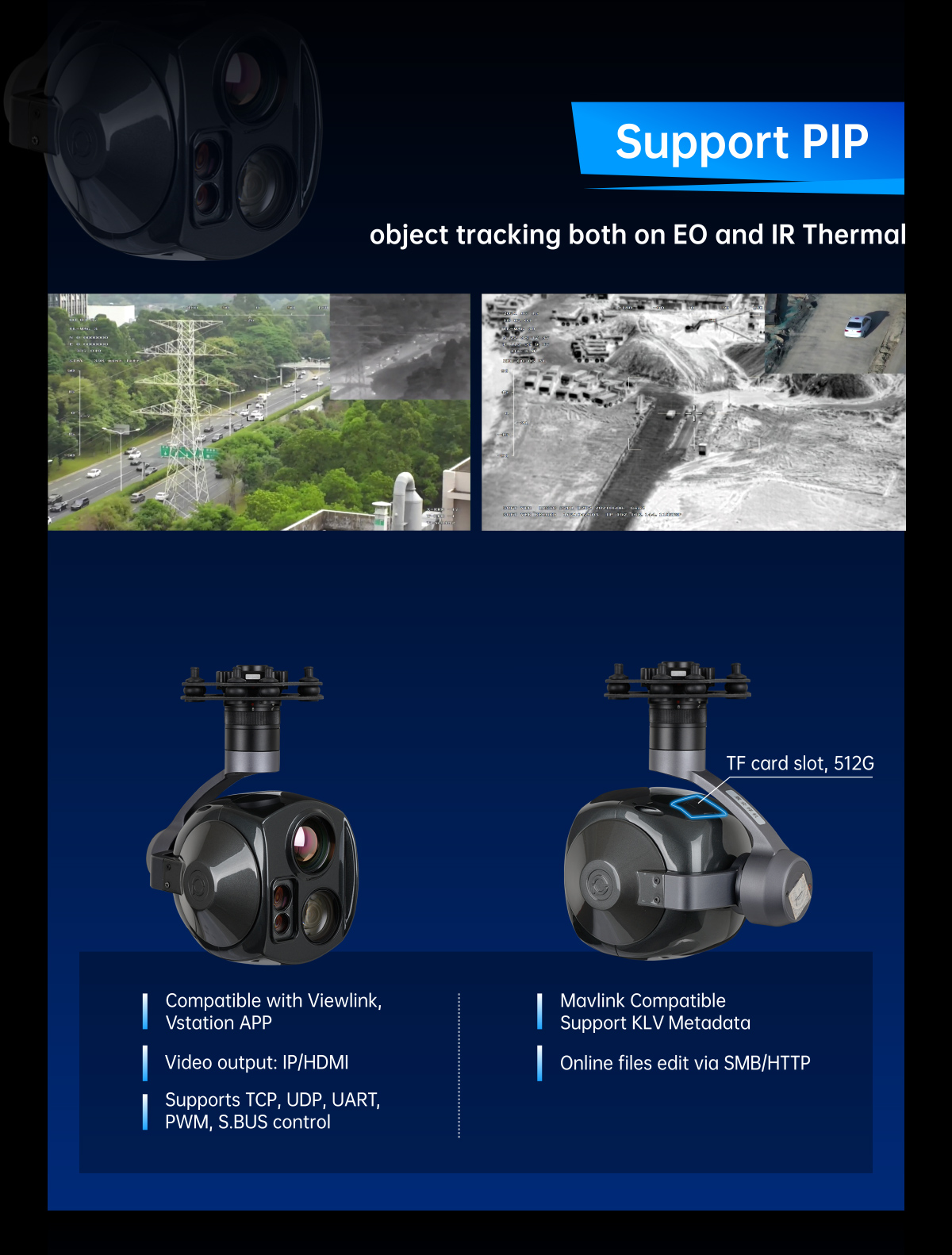
micro HDMI(1080P 60fps) / IP (RTSP/UDP 720p/1080p 25fps/30fps H264/H265) / SDI (1080P 30fps) |
| Local-storage |
SD card (Up to 512G,class 10, FAT32 format) |
| Picture storage format in TF card |
JPG(1920*1080) |
| Video storage format in TF card |
MP4(1080P 30fps) |
| Card reading online |
SMB read pictures or videos / HTTP read pictures or videos |
| Control method |
PWM / TTL / S.BUS / TCP / UDP |
| Geotagging |
Support, display time and GPS coordinate in picture exif |
| Gimbal Spec |
| Mechanical Range |
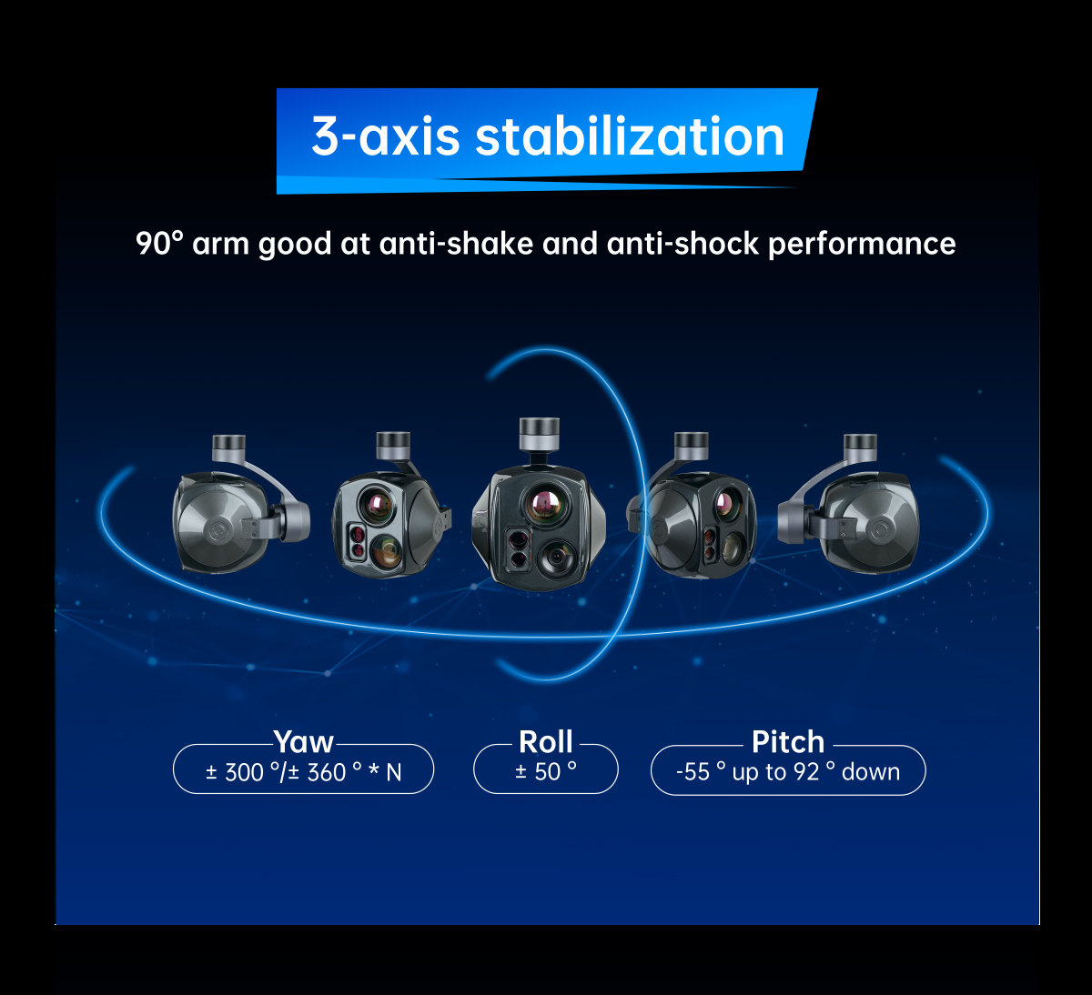
Pitch/Tilt: -55°~92°, Roll: ±50°, Yaw/Pan: ±300° / ±360°*N (IP / SDI output version) |
| Controllable Range |
Pitch/Tilt: -45°~90°, Yaw/Pan: ±290° / ±360°*N (IP / SDI output version) |
| Vibration angle |
Pitch/Roll/Yaw: ±0.02° |
| One-key to center |
√ |
| EO Camera spec |
| Imager Sensor |
1/2.8 Type STARVIS2 CMOS Sensor |
| Picture quality |
Full HD 1080 (1920*1080) |
| Effective pixel |
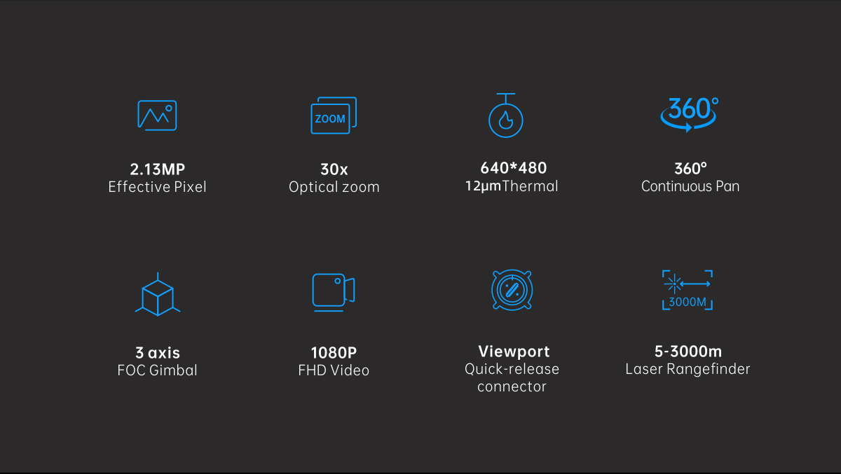
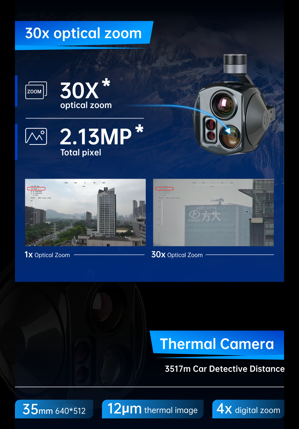
2.13MP |
| Lens optical zoom |
30x, F=4.3~129mm |
| Digital zoom |
12x (360x with optical zoom) |
| Min object distance |
10mm(wide end) to 1200mm(tele end) |
| Horizontal viewing angle |
64.0°(wide end) ~ 2.4°(tele end) |
| Sync system |
Internal |
| S/N ratio |
more than 50dB |
| Min illumination |
Color 0.009 lux (1/30 sec, 50%, High Sensitivity mode On) |
| Color 0.09 lux (1/30 sec, 50%, High Sensitivity mode Off ) |
| Exposure control |
Auto, Manual, Priority mode(shutter priority & iris priority), EV compensation, Slow AE |
| Gain |
Auto/Manual 0dB to 50.0dB(0 to 28 steps)
Max.Gain Limit 10.7 dB to 50.0dB (6 to 28 steps) |
| White balance |
Auto, ATW, Indoor, Outdoor, One Push WB, Manual WB, Outdoor Auto, Sodium Vapor Lamp (Fix/Auto/Outdoor Auto) |
| Shutter speed |
1/1s to 1/10,000s, 22 steps |
| Backlight compensation |
Yes |
| Defog |
Yes |
| IR Thermal Imager Spec |
| Focus Length |
35mm |
| Horizontal FOV(°) |
12.5° |
| Vertical FOV(°) |
10.0° |
| Diagonal FOV(°) |
16.0° |
| Detective Distance (Man: 1.8x0.5m) |
1458 meters |
| Recognize Distance (Man: 1.8x0.5m) |
365 meters |
| Verified Distance (Man: 1.8x0.5m) |
182 meters |
| Detective Distance (Car: 4.2x1.8m) |
4472 meters |
| Recognize Distance (Car: 4.2x1.8m) |
1118 meters |
| Verified Distance (Car: 4.2x1.8m) |
559 meters |
| Working mode |
Uncooled long wave (8μm~14μm) thermal imager |
| Detector pixel |
640*512 |
| Pixel pitch |
12μm |
| Focusing method |
Athermal prime lens |
| Emissivity correction |
0.01~1 |
| NETD |
≤50mK (@25℃) |
| MRTD |
≤650mK (@characteristic frequency) |
| Image enhancement |
Auto adjust image brightness and contrast ratio |
| Color palette |
White, iron red, pseudo color |
| Auto Non-uniform correction |
Yes (no shutter) |
| Digital zoom |
1x ~ 4x |
| Thermometry type |
Not support |
| Laser Rangefinder |
| Laser Wavelengths |
1550nm |
| Optical aperture |
Transmit 13mm / Receive17 mm |
| Resolution |
0.75m |
| Measure ability |
3000m (Typical value 1:
· Object size: the target surface is larger than the laser spot area
· Reflectivity: 60%
· Accuracy rate: 90%
· Visibility: 10 km
· Environment temperature: 20℃
· Atmospheric pressure: 1013 mbar) |
| Vehicle target measuring |
2300m (Typical value 2:
· Object size: 2.3*2.3 m
· Emissivity: 30%
· Others same as Typcial value 1) |
| Eye-safe |
Class 1【Standard IEC 60825-1, Second Edition (2007-03)】 |
| Laser beam angle (Typical value) |
1.0 mrad |
| Accuracy (Typical value) |
± 0.75m |
| Accuracy (In harsh condition) |
± 2m |
| Measurement frequency |
2Hz |
| Object resolution (Typical value) |
30m |
| EO / IR Camera Object Tracking |
| Update rate of deviation pixel |
50Hz |
| Output delay of deviation pixel |
5ms |
| Minimum object contrast |
5% |
| SNR |
4 |
| Minimum object size |
32*32 pixel |
| Maximum object size |
128*128 pixel |
| Tracking speed |
±48 pixel/frame |
| Object memory time |
100 frames (4s) |
| The mean square root values of pulse noise in the object position |
< 0.5 pixel |
| Features |
| OSD |
Display the gimbal’s yaw and pitch angle, magnification, ranging value, card recording duration, aircraft GPS and altitude or target ranging point GPS and altitude (choose one of them, and target ranging point GPS and altitude), date and time |
| Geotagging |
Display time and GPS coordinate in picture exif |
| Card reading online |
SMB read pictures or videos / HTTP read pictures or videos |
| KLV (UDP) |
Card recording or Viewlink video playback |
| ArduPilot / PX4 |
Support(Mavlink protocol )
Optional: Support Ardupilot Follow me feature |
| Video stitching |
EO+IR /IR+EO /EO /IR |
| Dual video stream output |
Not support(EO and IR two stream output) |
| Packing Information |
| N.W. |
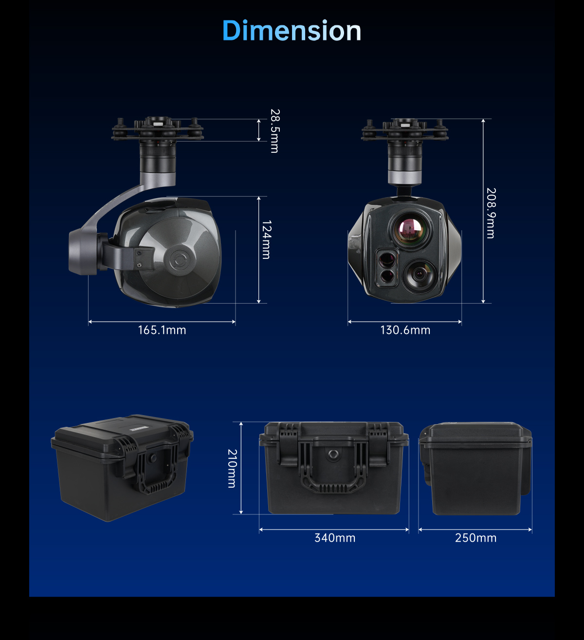
1116g / 1163g(Viewport version with Viewport) |
| Product meas. |
165.1*130.6*203.2mm / 165.1*130.6*208.9mm(Viewport version with Viewport) |
| Accessories |
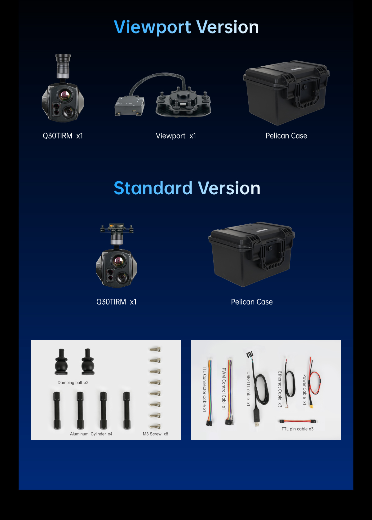
1pc gimbal camera device, screws, copper cylinders, damping balls,1pc USB to TTL cable / Hight quality plastic box with foam cushion |
| G.W. |
3518g |
| Package meas. |
360*300*250mm |

